Mid Atlantic Ridge: a vital path for Submarine Cable Systems
The Mid-Atlantic Ridge, a vast undersea mountain range stretching from the Arctic to the southern tip of Africa, has long been a formidable barrier for transatlantic submarine cable systems.
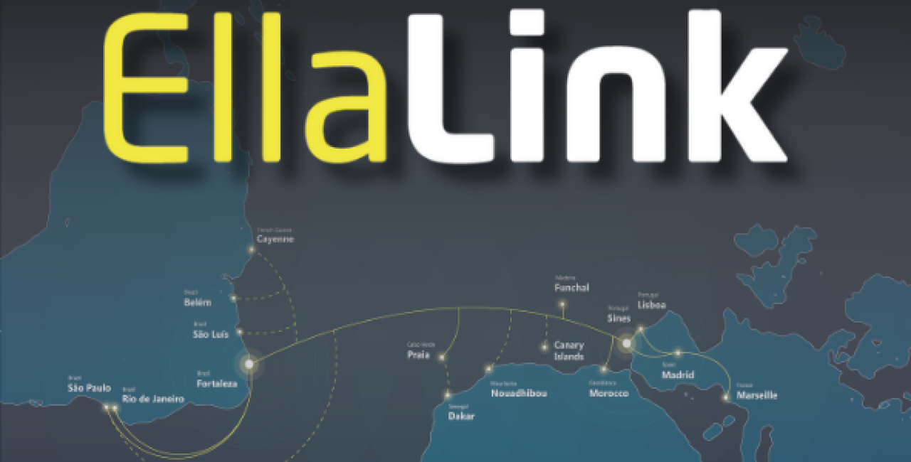
Historically, these systems routed cables through the North Atlantic, linking Europe to North America. However, new connectivity demands have shifted focus to a more direct route between Europe and Latin America, cutting through the ridge’s challenging terrain. This ambitious effort, led by the EllaLink project, underscores the importance of engineering innovation and scientific expertise in navigating this geological marvel.
From North Atlantic routes to EllaLink’s vision
Traditionally, submarine cable systems prioritized routes across the North Atlantic. Even today, these connections linked major hubs like Canada, New York, and Virginia Beach to Europe, establishing a strong foundation for global communications. However, the growing need for low-latency links between Europe and Latin America called for a new approach – one that leveraged the strategic geography of the Mid-Atlantic Ridge.
Why Latin America?
Latin America has emerged as a critical economic and technological region. Businesses and governments require faster, more reliable connections to Europe for data exchange, financial transactions, and digital services. The traditional North Atlantic routes could not efficiently meet this demand, prompting the need for a direct transatlantic link.
EllaLink’s Revolutionary Path
The EllaLink system directly connects Europe (Portugal) and Latin America (Brazil), a route that traverses the Mid-Atlantic Ridge, significantly reducing latency for users in both regions. By bypassing North American hubs, EllaLink introduces a streamlined path that enhances communication speed and security.
The Challenge of Crossing the Mid-Atlantic Ridge
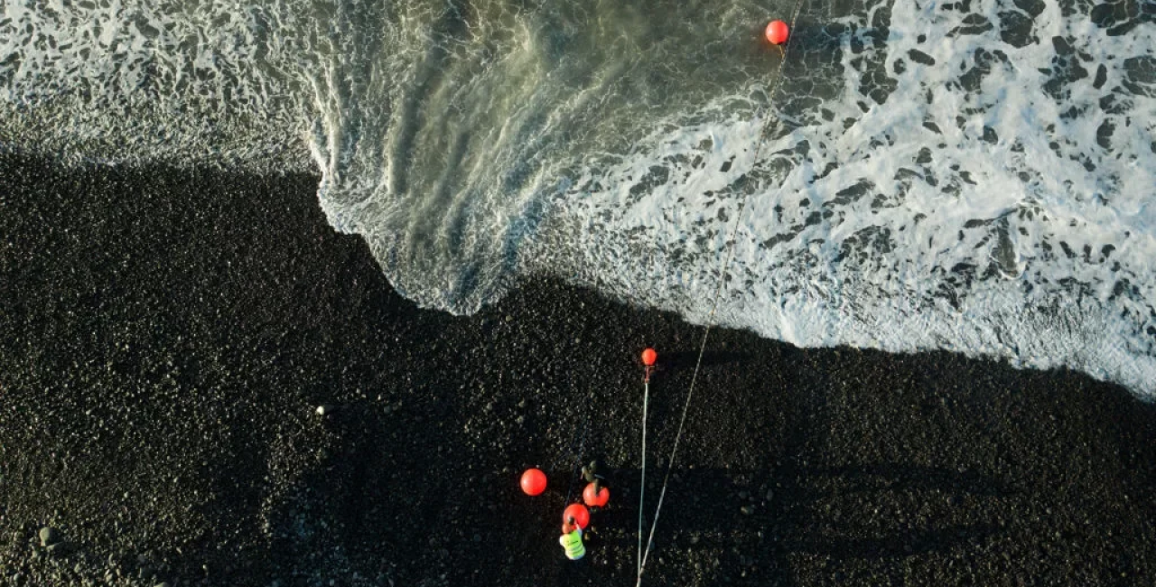
The most direct route between Europe and Brazil passes through the Mid-Atlantic Ridge, approximately 1,100 kilometres off Brazil’s northeast coast. While this path minimizes latency, it presents a host of engineering and environmental challenges.
Geological Complexity
The ridge results from tectonic plates diverging, with magma rising to create a new oceanic crust. This process has shaped a rugged terrain characterized by:
- Steep Slopes: peaks rising 2,000 to 4,000 meters above the ocean floor, with water depths exceeding 5,000 meters.
- Rift Valleys: deep valleys akin to underwater canyons running along the ridge’s crest.
- Seismic Activity: potential earthquakes and volcanic eruptions could add an element of unpredictability to the environment.
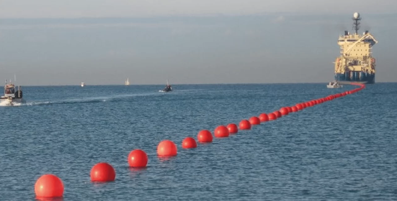
Engineering Solutions for EllaLink’s Route
EllaLink’s route design required meticulous planning to overcome the challenges of the Mid-Atlantic Ridge. Collaboration between marine engineers, geologists, and hydrographic surveyors ensured the project’s success.
Seafloor Mapping
The first step in planning EllaLink’s route was mapping the seabed. Surveyors created detailed ridge maps using advanced technologies like the Reson Seabat 7150 multibeam echosounder. These maps provided insights into the ridge’s terrain, helping engineers identify feasible paths for cable installation.
Seismic Risk Assessment
Tectonic activity along the ridge required a careful evaluation of seismic risks. By analyzing data from the IRIS database, EllaLink’s team identified areas with lower seismic activity, reducing the likelihood of cable damage from earthquakes.
Robust Cable Design
Given the ridge’s steep slopes and extreme depths, cables were designed to withstand harsh conditions. Using resilient materials and advanced laying techniques ensured the system could endure the region’s challenges while maintaining high performance.
The Mid-Atlantic ridge: more than a barrier
While the ridge is a significant obstacle for submarine cables, it is also a natural marvel and a focal point for scientific exploration. Its geological and ecological significance cannot be overstated.
Geological Insights
The ridge is an active site of seafloor spreading, where the Eurasian and North American plates in the North Atlantic and the African and South American plates in the South Atlantic are slowly moving apart. This process contributes to the Atlantic Ocean’s gradual expansion by 2 to 5 centimetres per year, offering scientists a live plate tectonics model.
Biodiversity Hotspot
Hydrothermal vents along the ridge support unique ecosystems, hosting life forms that thrive in extreme conditions. These communities are critical for understanding life’s adaptability and potential on other planets.
The Impact of EllaLink on Global Connectivity
EllaLink’s successful crossing of the Mid-Atlantic Ridge marks a milestone in submarine cable technology. It is an engineering triumph and a game-changer for global communication.
- Low Latency: EllaLink reduces latency between Europe and Latin America by 50%, making seamless real-time communication and data transfer.
- Increased Reliability: the direct route bypasses traditional North Atlantic connections, reducing potential points of failure and enhancing system reliability.
- Economic Growth: improved connectivity fosters collaboration between Europe and Latin America, driving innovation and economic development.
Looking Ahead: Future Challenges and Opportunities
The success of EllaLink demonstrates humanity’s ability to overcome natural barriers through innovation. However, it also highlights the need for sustainable practices in submarine cable installation.
Environmental Considerations
As demand for underwater cables grows, so does the need to protect marine ecosystems. Future projects must balance connectivity goals with conservation efforts, ensuring minimal impact on biodiversity hotspots like the Mid-Atlantic Ridge.

Expanding Networks
With the ridge successfully crossed, new possibilities emerge for connecting previously isolated regions. These advancements pave the way for a more interconnected world.
The Mid-Atlantic Ridge is more than just a geological feature; it is a challenge and an opportunity. The EllaLink project has demonstrated the potential of engineering innovation and highlighted the ridge’s critical role in shaping the future of global communication. As we continue to explore and utilize this underwater marvel, its significance as a connector of continents and a symbol of human ingenuity will only grow.
You May Also Like
EllaLink achieves major project milestones: marine survey, manufacturing and operator licenses
EllaLink announced today that it has been granted operator licenses by the Agência Nacional de Tele
NEW: EllaLink announces strategic restructuring
EllaLink is announcing today a strategic reorganization of its sales division to better align with m